Tuesday, April 14, 2009


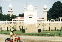
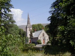
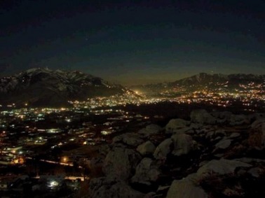
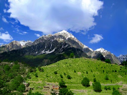
VIEW THE BEAUTIFUL IMAGES OF PAKISTAN's NORTHERN AREAS.

INTRODUCTION.

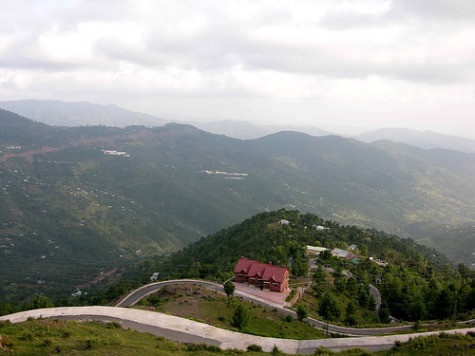
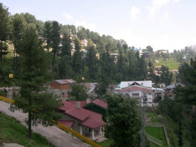
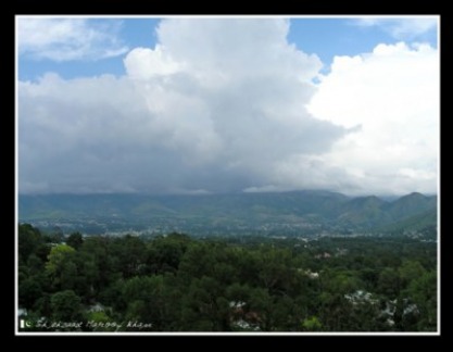
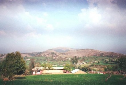
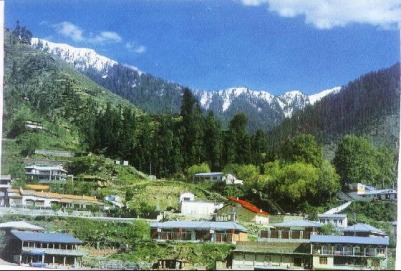
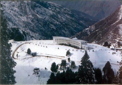
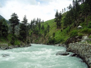
The northern areas of pakistan are one of the most beautiful spots in the world.It enjoys the possession of 13 out of 30 highest cliffs in the whole world.remarkably K-2 which is the second largest mountain of the world after Karakoram in Nepal.Through this site I will take you to the brief tour of these beautiful areas.


GILGIT

Gilgit(Urdu: گلگت) is the capital city of the Northern Areas, Pakistan and a tehsil (headquarters) of Gilgit District. Its ancient name was Sargin, later to be known as Gilit, and it is still called Gilit or Sargin-Gilit by local people, in the Burushaski language, it is named Geelt. Ghallata is considered its name in ancient Sanskrit literature. Gilgit city is one of the two major hubs on the Northern Areas for all mountaineering expeditions of Karakoram to the peaks of the Himalayas, the other hub being Skardu.

Gilgit has an area of 38,000 square kilometres (14,672 sq mi). The region is significantly mountainous, lying on the foothills of the Karakoram mountains, and has an average altitude of 1,500 metres (4,900 ft). It is drained by the Indus River, which rises in the neighbouring regions of Ladakh and Baltistan.


HISTORY OF GILGIT


Gilgit was an important city on the Silk Road through which Buddhism was spread from South Asia to the rest of Asia. A large number of Buddhist Sanskrit texts, included the long version of the Heart Sutra have been unearthed in Gilgit. The Dards and Cizinas also appear in many of the old Pauranic lists of peoples, with the former finding mention in Ptolemy's accounts of the region. Two famous travellers, Faxian, and Xuanzang are known to have traversed Gilgit as per their accounts.

“ 'The former rulers had the title of Ra, and there is reason to suppose that they were at one time Hindus, but for the last five centuries and a half they have been Mohommedans. The names of the Hindu Ras have been lost, with the exception of the last of their number, Shri Buddutt. Tradition relates that he was killed by a Mohommedan adventurer, who married his daughter and founded a new dynasty , since called Trakhane , from a celebrated Ra named Trakhan , who reigned about the commencement of the fourteenth century . The previous rulers of whom Shiri Buddut was the last were called Shahreis. ”


Gilgit
Mountainous region on the northwest frontier of Kashmir, under the rule of Pakistan; formerly a British Agency established in 1889; area 38,021 sq km/14,680 sq mi. It is drained by the Gilgit and Indus rivers. The region's town, Gilgit, was formerly a Buddhist centre. It lies at nearly 1,500 m/5,000 ft above sea level; during the winter the town can be approached only by plane.

Monday, April 13, 2009

HUNZA VALLEY


Hunza Valley(URDU: ہنزہ) is a mountainous valley in Gilgit in the Gilgit-Baltistan region of the Northern Areas of Pakistan. The Hunza valley is situated at an elevation of 2,438 metres (7,999 feet). The territory of Hunza is about 7,900 km² {3,050 mi²). Karimabad (formerly called Baltit) is the main town which is also a very popular tourist destination because of the spectacular scenery of the surrounding mountains like , Ultar Sar, Rakaposhi, Bojahagur Duanasir II, Ghenta Peak, Hunza Peak, Darmyani Peak, and Bublimating (Ladyfinger Peak), all 6,000 m (19,685 ft) or higher.

Hunza,a remote mountain kingdom,may have been the inspiration behind James Hilton's"SHANGRI-LA".The area opened up in the 1970s following the completion of Karakoram highway;an engineering marvel tracing the old silk route from Pakistan into China.
The fair skinned and light-eyed Hanzakuts claim to be descendants of soldiers lost from Alexander's army invaded India.Their language Burushaski,privides linguists an enigma as it is unrelated to any other language known to man.
The beauty of this mountain paradise is matchless;from the soft blossoms of the apricot trees to the dark snoew capped rock monuments of Rakaposhi (7788m.)and recently climbed altar (7388m.)jabbing a vivid blue backdrop high above.
GEOGRAPHY OF HUNZA


The Hunza is situated at an elevation of 2,438 metres (7,999 feet). For many centuries, Hunza has provided the quickest access to Swat and Gandhara for a person travelling on foot. The route was impassable to baggage animals; only human porters could get through, and then only with permission from the locals.

Hunza was easily defended as the paths were often less than half a metre (about 18") wide. The high mountain paths often crossed bare cliff faces on logs wedged into cracks in the cliff, with stones balanced on top. They were also constantly exposed to regular damage from weather and falling rocks. These were the much feared "hanging passageways" of the early Chinese histories that terrified all, including several famous Chinese Buddhist monks such as Xuanzang


CLIMATE


The temperature in May is maximum 27 °C (81 °F) and minimum 14 °C (57 °F) and October maximum is 10 °C (50 °F) and 0 °C (32 °F).
Hunza's tourist season is from May to October,
because in winter the Karakoram Highway is often blocked by the snow

Sunday, April 12, 2009

MURREE

MURREE , a town and sanatorium of British India,in the Rawalpindi district of Punjab,7517ft above the sea,about 5 hours journey by cart-road from Rawalpindi town,and the starting point for Kashmir.The houses are built on the SUMMIT and sides of an irregular ridge,and command magnificiebt viewsa over

Murree city (Urdu: مری) is a popular hill station and a summer resort, especially for the residents of Islamabad, and for the cities of the province of Punjab, Pakistan. It is also the administrative centre of Muree Tehsil, which is a sub-division of Rawalpindi district and includes the Murree hills.

MALL ROAD.

Mall road is the famous market place and one of the most crowded place in Murree. It's good to go there when you get hungry and want to have a good lunch or dinner. It can be best visited after the sunset. Also if you want to save time visit hills at day time and Mall Road at night when you have to just shop or dine. It is a slope starting from General Post Office. Food & misc. sovenier shops are situated on the both sides of Road. It is open till midnight. You can buy everything at Mall and dine a variety of Pakistani dishes.


ABBOTTABAD


INTRODUCTION.

Abbottabad (Urdu: ایبٹ آباد) is a city located in the province of NWFP, Pakistan and is the second-largest city in the province after Peshawar. The city is situated in the Orash Valley, 150 km north of Islamabad and 200 km east of Peshawar at an altitude of 4,120 feet (1,260 m). The city is known for its pleasant weather, educational institutes and military establishments. It remains a major hub for tourism in the summer

Welcome to travelpage of my native town Abbottabad which is a small neat and clean town in a spacious valley surrounded by lush green hills. It is a popular summer resort of lower himaliyan region with height of 1,220 meters.

Abbottabad is well known for its verdant parks, gardens, golf course, pine covered hills, famous educational institutions and Military Academy. It also serves as the gateway to most beautiful places in Pakistan. Its located in North West Frontier Province just two hours drive and 116 Km from Rawalpindi / Islamabad.

The mighty mountain ranges of the Karakorams, the Himalayas and the Hindukush could be reached through Abbottabad, the gateway to Silk Route. Northern areas of Pakistan and Kashmir are also connected with rest of country through Abbottabad


ABBOTTABAD'S MOSQUE


ABBOTTABAD'S CHURCH.

Polo, Soccer, Golf and Hockey are the most popular games played in the Abbottabad valley . The Cantonment area of Abbottabad is still very British. The European bungalows, the club, the church and cemetery are still there. Abbottabad is an hour's drive from Nathiagali, the summer capital of the North West Frontier Province.

Famous tourist resorts of lower Himaliyas such as Nathiagali, Ayubia, Thandiyani and Murree are located very close to Abbottabad.

Weather in Abbottabad during summers remains very pleasant. Many tourists come here for holidays from all over the country. In winters weather remain very cold with light snowfall from time to time. In winters all the mountains of valley are covered with snow and look beautiful.

If you want to spend your holidays in a pleasant, peaceful and lush green British style destination then Abbottabad is the right choice


~* TOWN ABBOTTABAD *~

(By: Major JAMES ABBOTT)
(1st Deputy Commissioner, Hazara)

I remember the day I first came here,
And smelt the sweet Abbottabad air.
The trees and the ground covered with snow,
Gave us indeed a brilliant show. 4

To me the place seemed like a dream,
And far ran a lonesome stream.
The wind hissed as if welcoming us.
The pines swayed creating a lot of fuss. 8

And the tiny cuckoo sang it away,
A song very melodious and gay.
I adored the place from the first sight,
And was happy that my coming here was right. 12

And eight good years here passed very soon,
And we leave you perhaps on a sunny noon.
Oh Abbottabad! We are leaving you now,
To your natural beauty do I bow. 16

Perhaps your winds sound will never reach my ear,
My gift for you is few sad tears.
I bid you farewell with a heavy heart,
Never from my mind will your memories thaw.


SWITZERLAND OF PAKISTAN,"SWAT"

Swat (Pashto/Urdu: سوات) is a valley and an administrative district in the North-West Frontier Province (NWFP) of Pakistan located 160 km/100 miles from Islamabad, the capital of Pakistan. It is present in the Hindu Kush range, in the Pakistan area. The capital of Swat is Saidu Sharif, but the main town in the Swat valley is Mingora.It was a princely state in the NWFP until it was dissolved in 1969. With high mountains, green meadows, and clear lakes, it is a place of great natural beauty that used to be popular with tourists as "the Switzerland of Pakistan


CLIMATE

swat lies in the Temperate Zone in the northern mountainous ranges of the Indo-Pak Sub–Continent, hence weather is affected by all the climatic factors “latitude, altitude and rain bearing winds”
In summer, Swat comes under the influence of the monsoon, while in winter, it is affected by the Cyclonic Current from the Mediterranean Sea.


Past Of SWAT

The beautiful valley of Swat has a unique place in the fields of education and literature. It has produced great intellectuals and scholars. But in this land of amazing beauty, civilizations are forgotten.

Various religions have flourished here, and this land has seen their rise and decline. The imprints of their culture can be easily seen in archaeological sites in Swat. Some of the relics are reflective of great inclination towards knowledge. From the Kuldanees to Aryans, Greeks to Mughals and the Britishers, all have left their marks on this land of Pakhtoons. The history of Swat has thus got a shape, reflecting cultural, economic, religious and political glimpses of these nations. We can easily judge from the various aspects of their lives the position of Swat in the files of education then.

Renowned historian, late Abdul Haleem Asat Afghani, in his “Swat Da Tareekh Pa Rana Kay”, says that of all the people who came to Swat, the Kuldanees left everlasting imprints of their culture on this land. The Kuldanees maintained sway over Swat from 2500 B.C to 500 B.C. The two inscriptions found from the archeological remains of Khadokhel, which belong to the age of Dareyoosh Kabir, are kept in Lahore Museum. The inscription point out that the relics of Kuldanee culture can be traced on the outskirts of Kanju.


THE RIVER OF SWAT


The Swat River is mentioned in the Rig Veda 8.19.37 as the Suvastu river.The first historical mention of the valley goes back to a hymn of the Rigveda(Stein, 1929:viii


free counters